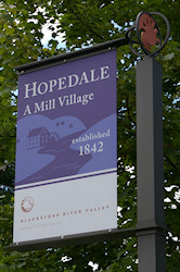
Hopedale Tour Review
 |
Basic Information | |
| Current Tour PDF | Google Map | |
| Other Tour PDFs | 2001 | |
| 2012 | ||
| When I took the tour | ||
| Tour PDF | 2001 | |
| Date | Jul 19, 2009 | |
| Time | 2:40 pm to 4:40 pm | |
| Walking Distances (miles) | ||
| Basic Tour | 1.1 | |
| See the About page for help |
My Extensions | 0.4 |
| Parks, Cemeteries & Other | 0.3 | |
Although I lived near Hopedale for two decades I’d never visited its downtown area. All the state highways pass through town outside of the downtown area and none of its streets are useful shortcuts for getting to other places in the valley. I made my first visit on a Sunday so I was able to park right in front of the library on Hopedale Street.
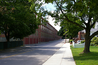
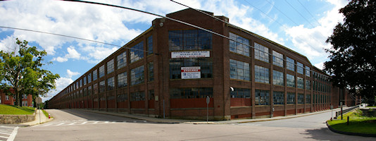
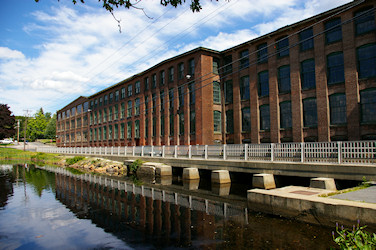
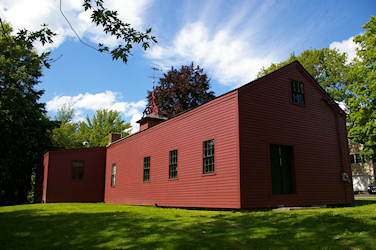
Leaving Ballou Park the Draper Manufacturing Plant looms large covering the next 3½ blocks of Hopedale Street. This massive three to four story L shaped structure with a 1000 x 800 foot frontage is vacant but is maintained well enough to avoid the ghost town feel of so many abandoned mills. There where even some hanging plants giving a little color to the scene and attracting this Silver-spotted Skipper.

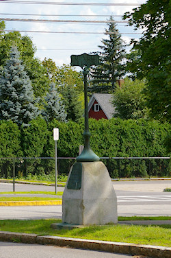
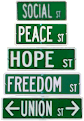
Half way along the plant on the opposite side of the street stands the former Draper office building. It has been beautifully restored and now houses the Atria Draper Place senior community. After the office building is a grass covered lot with a few trees and shrubs but no buildings on this half of the block. There is a small granite post marked “Community Square” but no mention of this site is made in the NPS walking tour pamphlet so I continued along the walking tour. Later I searched around the net and found that this was the site of the 1844 School and Chapel building for the Hopedale Community. I found this information in a different walking tour prepared by the Friends of Adin Ballou. Viewing the block in Google Earth I see there is an entrance on Freedom Street, I’ll have to check out this place next time I visit. Two other sites on the alternate tour I want to visit are the Hopedale Village Cemetery and Nelson’s Grove, site of the annual Abolitionist picnic.
When you get to the intersection with Freedom Street there is a great view of the manufacturing plant that really shows off its massive size.
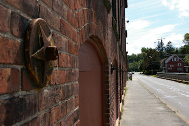
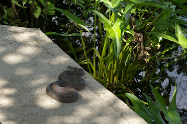
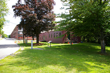
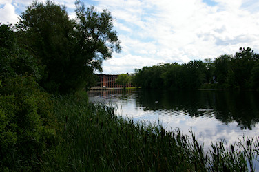
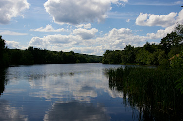
Before heading to the next tour site, walk down the Freedom Street side of the plant. The first section of the building is the same as the Hopedale Street side, a massive 20th century corporate feel created by the wide institutional windows. The style changes on the next section to a more vertical feel with narrower, segmented arch topped windows. The rough front stone windowsills and star decorated anchor plates also contribute to what I find a more attractive style. Around where the Mill River runs into the building the style becomes even more vertical by recessing the window areas creating brick pilasters. After viewing the river going into the plant I continued to the end of the bridge and across the street. Looking at the plant from this vantage point the differing architecture makes the plant look less monolithic than it does from Hopedale Street. From here there is also a good view of the south end of Hopedale Pond where I saw a Northern Water Snake basking on the concrete.
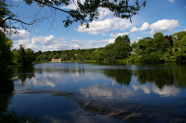
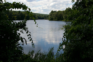
Leaving the shop I walked near the shore of Hopedale Pond catching nice views of the pond through the trees and bushes. Just before I got to the entrance of the Parklands a Squirrel started making a racket in the trees right next to me. Looking around I saw a mother Gray Squirrel with a baby or two in her mouth, I must have startled her as she was moving them to a new nest.

I hate when there is so much conflicting information over what should be a basic fact, the size of The Parklands. To figure this out I decided to independently measure the area from maps. I took the original 1913 map by Mr. Manning ’s company and loaded it into Google Earth as an overlay to check the scaling. The map scale says “1 inch = 100 feet” and the drawn scale appears to be labeled 0, 50, 100, 150, 200, 300, 400, 500. After placing the image into GE I measured the length of the scale using the ruler tool and it came out to 500 feet. Knowing that I was reading the scale correctly I created a PDF of the map.
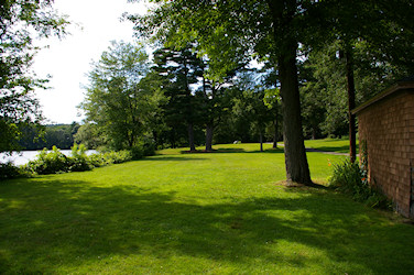
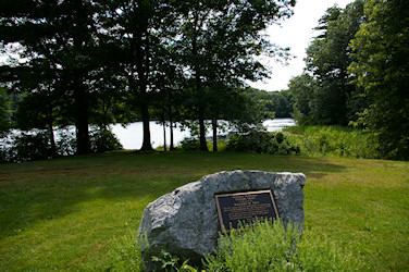
I used the length measuring tool in PDF-Xchange Editor to determine the scaling factor for the PDF (it’s 2.17" = 500 ft). With the scaling determined I used the area measuring tool to get a value for the entire Parklands, the pond and the islands. I came up with 254, 86 and 4 acres respectively. Taking the total subtracting the pond and adding back in the islands gives 172 acres, within 5% of the town’s value. Clearly the town is correct while the NPS is wrong by a factor of five. I believe I’ve figured out why the third references say the pond and islands are thirty-six acres. The town web site says the pond is 86 acres, my measurement also came up with 86 acres. I think 36 is a simple transcription error of 86, subtracting 86 instead of 36 from the 273 gives 187acres, within 4% of the towns number. I only walked a little way into the park stopping at the entrance to the extensive nature trails. This is another Hopedale place I want to explore further someday.
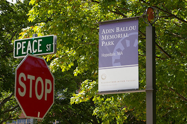
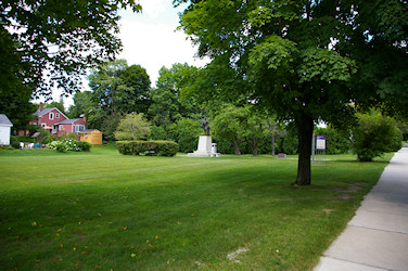
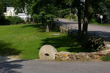
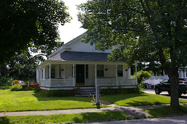
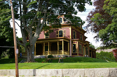
Heading back south on Dutcher Street, after crossing Hopedale/Northrup Street, on the left is the Town Park designed by Warren Henry Manning. The park extends for the whole block ending at the corner of Dutcher & Freedom Streets where an old mill stone decorates the entrance. The third house on the right side of the street is the well maintained Adin Ballou house.
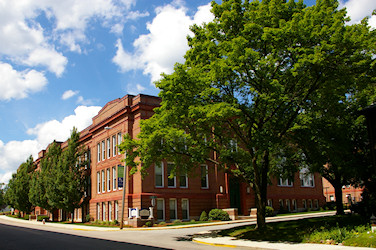
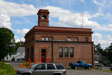
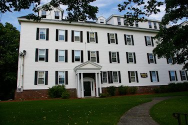
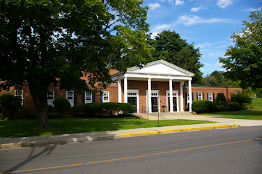
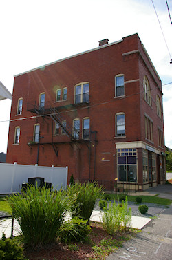
Continuing along the tour path there are more interesting buildings, the Dutcher Street School was an elementary school now renovated and converted to condominiums. The next block has the Central Fire Station, opened in 1916 and still the main fire station for the town. Across Dutcher Street is the large 100+ room Hopedale House, formerly a rooming house for company employees who lived alone, it is now an apartment house named Hopedale Manor.
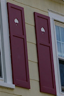
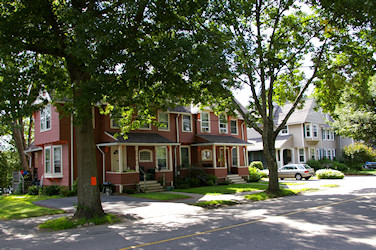
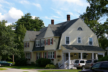
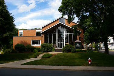
It is surprising how many different architectural styles are on display along this tour. The most amazing part is how the owners of these homes take such great care of these pieces of history. Even simple structures show off the attention to detail and the more elaborate homes have incredible details like these gable decorations and ornamental brackets at the corner of Dutcher and Union streets. Keeping up with maintenance on wooden structures in New England is a difficult chore and the residents of downtown Hopedale deserve our thanks for their efforts.The mixture of styles generally works very well in this downtown area with only one building looking out of place to me. The Union Evangelical Church built in 1964 seems out of place on Dutcher Street, the modern architecture just doesn’t seem to fit in with the other buildings around it.

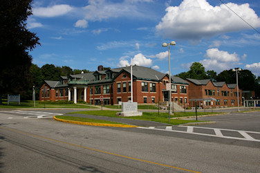
I was puzzled two blocks farther along to see a huge elaborate building and grounds covering the entire block. No mention of this enormous structure is made in the NPS tour brochure, later research showed me this is the Hopedale Community House. Opened in 1923 it was funded by the Draper family to provide recreation and social activities for the residents of Hopedale and Draper Company employees. On the other side of the street is the Draper Gymnasium also built for the recreation of town residents.
Heading to the corner of Adin and Dutcher Streets for the next tour site I had a good view of the Unitarian Church with Town Hall in the background. The William Draper street sign at the corner was a gift to the town according to the NPS tour. However the plaque on the base of the sign states that William gave the street to the town, not just the sign.
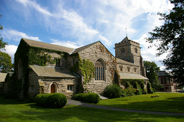
The corner lot on Adin Street across Dutcher from the old sign has a magnificently restored 19th century home. The High School on the other side of Adin Street is a modern building but great care was obviously taken to ensure that its architecture fits in well with the rest of the area. Proceeding down Adin Street, on the other side of Hopedale Street there is a nice pair of homes with handsome decorative woodwork. Turning north up Hopedale Street is the front view of the beautiful granite Unitarian Church.
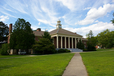
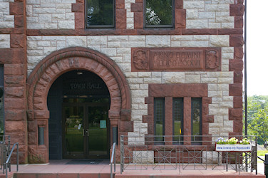
Across the street from the church is the Town Hall made of Milford granite with Longmeadow brownstone accents and carvings. The look of this building is unusual, I’m not sure I like the style but it is clearly unique making it stand out from the other buildings in town, as a town hall should in my opinion.

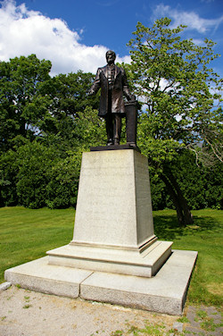
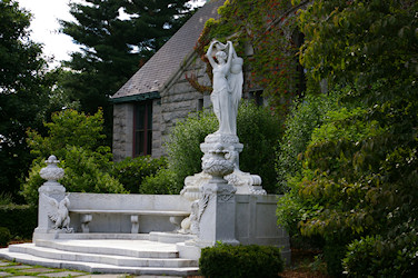
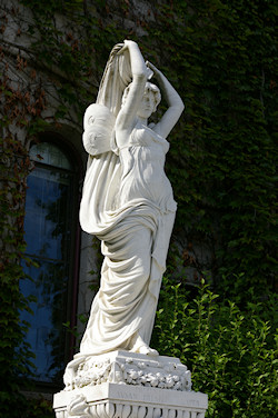
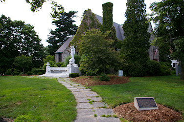
Approaching the final tour site I was struck by the beauty of the Carrara marble Statue of Hope Fountain. Susan Preston Draper, wife of William Draper US Ambassador to Italy, wanted to send a gift of public art to the town. In Rome Mrs. Draper commissioned American Sculptor T. Waldo Story to create this work which was shipped to Hopedale in 1904.

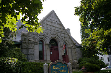
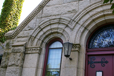
The final stop of the tour is another beautiful Milford granite building the Bancroft Memorial Library. It was designed by the architect C. Howard Walker of Boston who was inspired by the Merton Chapel at Oxford University. The library was commissioned by Joseph Bancroft in memory of his wife Silvia and given to the town upon completion in 1899.
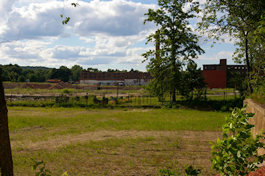
Down behind the library is a parking lot for the library, I didn’t see any signs there limiting parking so, it seems like it would be OK to park there when the library is closed. This could also be helpful if you want to stay longer touring the town than the time limited parking on Hopedale street allows. From the back of the parking lot there is a good view of the back areas of the Draper Manufacturing Plant. In 2008 this area was used for filming some of the movie Surrogates".
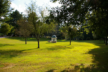
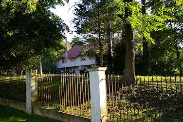
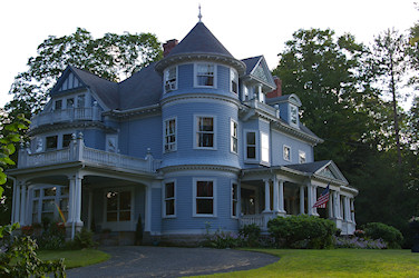
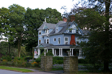
A month or so after taking the tour I visited Adin Park at the intersection of Adin Street and Route 16. The park features a restored Cupola from the Eben Draper Bancroft house that burned down around 1940. At the back side of the park you get a little view of an interesting Mediterranean style tile roofed and stucco covered private estate. Walking along Adin Street there are many lovely homes with beautiful landscaping.
I was surprised at the beauty of the little Town of Hopedale, hidden from the main highways it has retained its charm into the 21st century. There are so many more sites to explore that I’m sure I’ll return many times in the coming years before I see it all. Starting as a utopian community that failed economically then becoming a company town that failed like almost all large industry in the valley it has many interesting historical stories to tell. I hope the town is able to find a way to reuse the Draper Plant although since they’ve been trying for close to thirty years already it obviously isn’t going to be easy, I wish them luck in their endeavors.
More Information about Hopedale
Town of Hopedale - A History of Hopedale
Hopedale, Massachusetts - Wikipedia
Hopedale Community - Wikipedia
Sheltered from the Wicked World: Stories and Pictures from Hopedale’s Past
Hopedale Unitarian Parish, Tiffany stained glass windows, History
Ballou, Adin. History of the Hopedale community, from its inception to its virtual submergence in the Hopedale parish. Edited by William Sweetzer Heywood. Lowell, Mass.: Thompson & Hill.
Hopedale Reconnaissance Report of the DCR Historic Landscape Preservation Initiative